
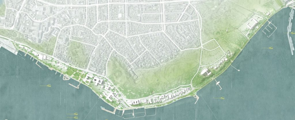
Fig. 1: Overview plan of the winning design in the urban development and open space planning competition for the redesign of the Kiellinie. Studio RW Berlin, Studio Wessendorf Berlin, Plancontrol Berlin. Source: LH Kiel
The Kiellinie, one of Kiel's most iconic and popular locations, is being redesigned along its entire length from the Schlossgarten s to the naval base in Wik. The aim is to move away from the charm of the 1970s and develop a contemporary and sustainable promenade. The advanced plans envisage that the entire area will be modernised, renovated, made more climate-resilient and more people-friendly.
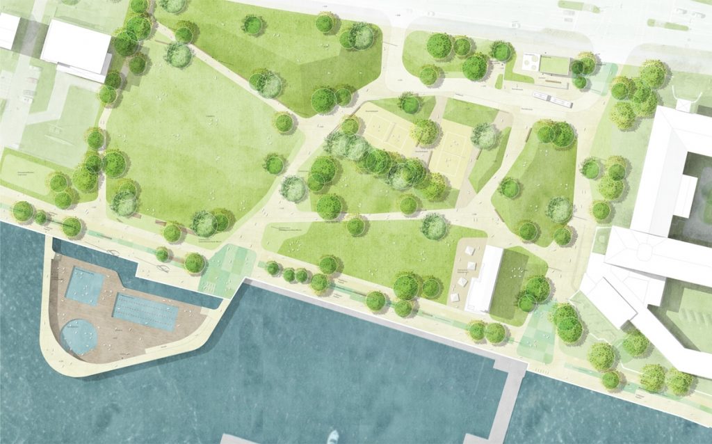
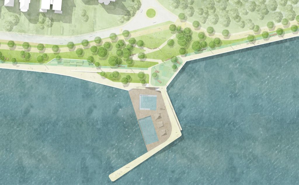
Fig. 2 and 3: Site plans of Reventlouwiese (left) and Berthold-Beitz-Ufer / Bellevuebrücke (right) (r.) from the winning design of the urban development and open space planning competition for the redesign of the Kiellinie. These plans have already been revised and therefore do not reflect the current state of planning. Studio RW Berlin, Studio Wessendorf Berlin, Plancontrol Berlin. Source: LH Kiel.
While there is no longer any debate about whether Holstenstraße, Kiel's central pedestrian zone, should be open to car traffic (as it used to be) or whether the southern promenade should be car-free, which it fortunately is today, no decision has yet been made regarding the northern section of the Kiellinie.
From a practical and scientific point of view, the urban planning and open space planning perspective is crystal clear: the northern Kiellinie can only improve in terms of quality of life if there is no longer any through traffic for motor vehicles.
In terms of party politics, the situation is naturally different at the local level, as some parties and stakeholders still believe that car traffic is necessary everywhere and that changing the status quo would restrict everyone's freedom.
Of course, it is clear that this is very backward-looking, one-sided and not true.
Even half-baked solutions that are packaged as accommodating compromises, such as allowing car traffic to travel in only one direction, do not solve the root of the problem.
We are convinced that a car-free design, including an integrated traffic and measures concept for the adjacent residential areas (for example, to prevent motorists from misusing neighbourhood streets as shortcuts), represents the greatest benefit for everyone in Kiel.
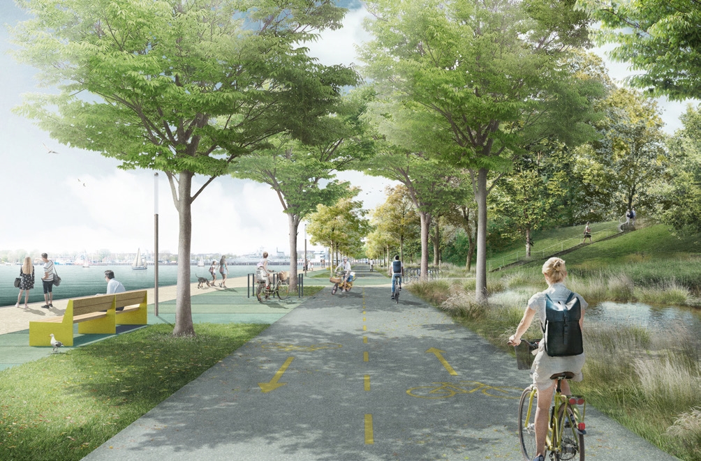
Fig. 4: Visualisation of the winning design in the urban development and open space planning competition for the redesign of the Kiellinie. Variant without car traffic on the northern Kiellinie. Studio RW Berlin, Studio Wessendorf Berlin, Plancontrol Berlin. Source: LH Kiel.
For us, it is clear that Kiel must move forward and not maintain the status quo, based on a supposedly easy solution, out of convenience, irrational arguments, ignorance or indifference.
Kiel kann schöner sein – lasst uns diesen Schritt wagen.
“The Kiellinie Nord offers great development potential for the Kiellinie as a whole. The vision of the Kiellinie Nord is: the fjord slope meets the Kiellinie and the fjord – life and greenery on the fjord slope and along the promenade meet the blue.”
LH Kiel (2020): Kiellinie und Düsternbrooker Fördehang – Vorbereitende Untersuchungen mit integriertem städtebaulichen Entwicklungskonzept, S. 193.
Links:
Source of all images:
State capital Kiel. Competition entry 1013 1. Price. Studio RW Berlin, Studio Wessendorf Berlin. URL: https://www.kiel.de/de/kiel_zukunft/kiel_plant_baut/_wettbewerb_kiellinie/kiel_kiellinie_wettbewerbsarbeit_1013.php (Date: 30.07.2025)